Improving Usability, Efficiency, and Safety of UAV Path Planning through a Virtual Reality Interface
PubDate: Apr 2019
Teams: Jesse Paterson, Jiwoong Han, Tom Cheng, Paxtan Laker, David McPherson, Joseph Menke, Allen Yang
Writers: Jesse Paterson, Jiwoong Han, Tom Cheng, Paxtan Laker, David McPherson, Joseph Menke, Allen Yang
PDF: Improving Usability, Efficiency, and Safety of UAV Path Planning through a Virtual Reality Interface

Abstract
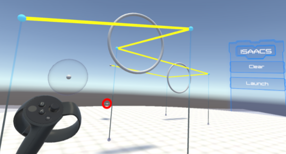
As the capability and complexity of UAVs continue to increase, the human-robot interface community has a responsibility to design better ways of specifying the complex 3D flight paths necessary for instructing them. Immersive interfaces, such as those afforded by virtual reality (VR), have several unique traits which may improve the user’s ability to perceive and specify 3D information. These traits include stereoscopic depth cues which induce a sense of physical space as well as six degrees of freedom (DoF) natural head-pose and gesture interactions. This work introduces an open-source platform for 3D aerial path planning in VR and compares it to existing UAV piloting interfaces. Our study has found statistically significant improvements in safety and subjective usability over a manual control interface, while achieving a statistically significant efficiency improvement over a 2D touchscreen interface. The results illustrate that immersive interfaces provide a viable alternative to touchscreen interfaces for UAV path planning.


