An open‐source system for vision‐based micro‐aerial vehicle mapping, planning, and flight in cluttered environments
PubDate: June 202
Teams: microsoft
Writers: Helen Oleynikova Christian Lanegger Zachary Taylor Michael Pantic Alexander Millane Roland Siegwart Juan Nieto

Abstract
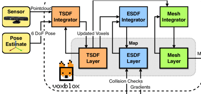
We present an open‐source system for Micro‐Aerial Vehicle (MAV) autonomous navigation from vision‐based sensing. Our system focuses on dense mapping, safe local planning, and global trajectory generation, especially when using narrow field‐of‐view sensors in very cluttered environments. In addition, details about other necessary parts of the system and special considerations for applications in real‐world scenarios are presented. We focus our experiments on evaluating global planning, path smoothing, and local planning methods on real maps made on MAVs in realistic search‐and‐rescue and industrial inspection scenarios. We also perform thousands of simulations in cluttered synthetic environments, and finally validate the complete system in real‐world experiments.


